
Like guides like this? Get new ones by email.
South Achenbach doesn’t get talked about the way Caprock Coulee or the overlooks do, and after hiking it, I get why — and also why that’s exactly the point. This is the North Unit’s most remote trail, it barely sees foot traffic, and for about five hours it was just me, a river I had to jump across, and more bison than I could keep count of.
Plan your visit: Check the official Theodore Roosevelt National Park NPS page for current conditions, river levels, and any active advisories in the North Unit before you go. More from this park: Caprock Coulee Trail, Bison Safety, and Theodore Roosevelt NP: Best-Kept Secrets.
The Quick Stats
- My hike: ~5 miles in, 5 miles back out — 9.85 miles round trip, ~1,447 ft elevation gain, 3:57:30 moving time (logged on AllTrails)
- Full trail: South Achenbach runs 10.6 miles one-way to Juniper Campground, crossing the Little Missouri River twice (no bridges)
- Difficulty: NPS rates it Difficult — rough terrain, a river crossing, and extreme weather can challenge even well-prepared hikers
- When I hiked it: September 13, 2026, starting around 10am Central
- Where: North Unit, Theodore Roosevelt National Park, North Dakota, starting from the Oxbow Overlook trailhead
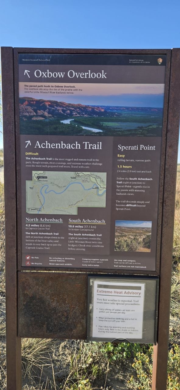 The trailhead sign at Oxbow Overlook. Go right at the junction for South Achenbach Trail and Sperati Point; the sign doesn’t undersell it — Achenbach really is billed as the most rugged and remote trail in the park.
Starting at Oxbow Overlook
The trail starts from Oxbow Overlook, which gives you a preview of the river valley you’re about to drop into before you even start hiking.
I started by taking the short detour out to Sperati Point first — easy terrain, rolling and narrow, with genuinely great badlands views for only 2.4 miles round trip. Then I backtracked to the junction and started down South Achenbach proper, toward the river.
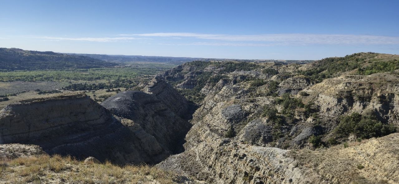 The view from Sperati Point — easy walking, and worth every bit of the short detour before dropping down into Achenbach proper.
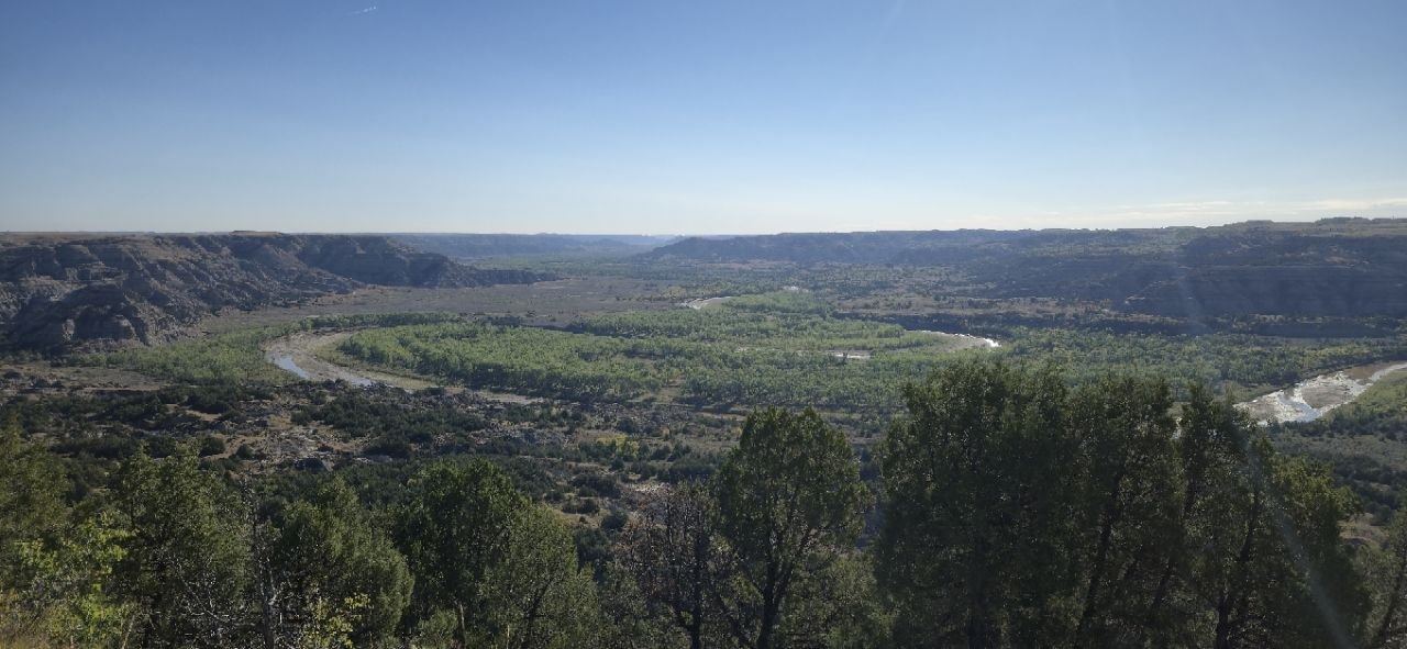 Another angle from up near Sperati Point, before the trail drops down toward the river.
The Trail Itself: Quiet, and Easy to Lose
This is where the “remote” label earns itself. The trail is not well marked, and it doesn’t feel like it gets much use — I was the only person on it the entire way down and across the river. The only other people I saw all day were a couple of groups headed out to Sperati Point as I was hiking back in near the trailhead. Past that junction, I had the whole valley to myself.
I lost the actual trail line more than once, especially in overgrown sections, and leaned on AllTrails a lot to stay on track. If you’re used to well-graded, well-signed National Park trails, recalibrate — this one is closer to a route than a maintained trail in places.
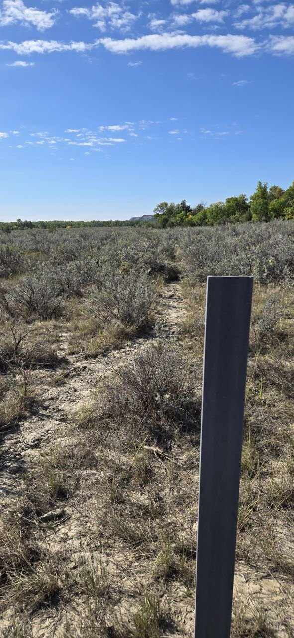 This is about as much trail marking as you get on long stretches of Achenbach — one post, and a footpath that’s more suggestion than trail.
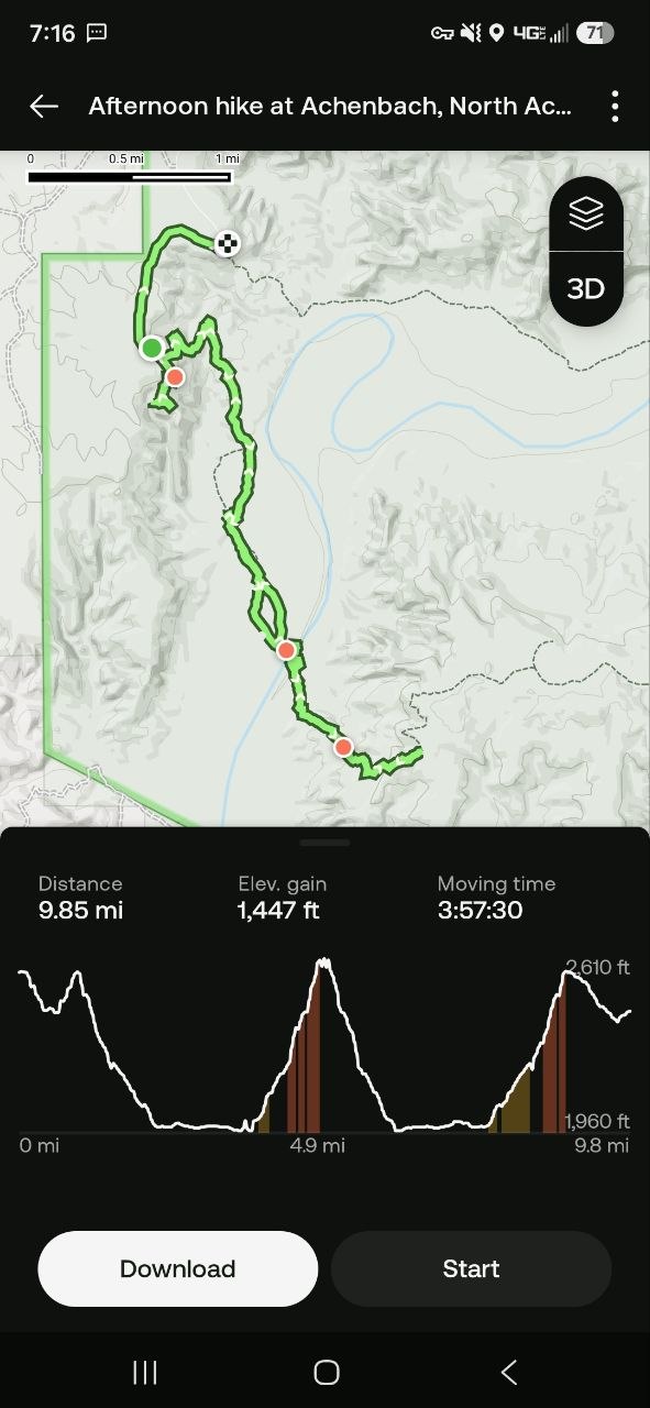 The recorded route: down to the river, across, up to a vantage point on the far side, and back the same way. AllTrails carried the navigation on the sections where the trail itself disappeared.
Bison: Three Herds, 50+ Animals, and One Real Encounter
I tried to keep a running count of bison and gave up. Between three separate herds and a couple of lone bulls off doing their own thing, I’m confident I saw more than 50 animals over the course of the hike.
The real moment came right at the river crossing. I came out of the brush along the bank and walked straight into a herd that was already down near the water — they spooked, bunched up tight in that classic defensive-herd instinct, and the lead bull started actively pushing the group together. I could hear him bellowing from about 75 yards away. It was genuinely one of the coolest bison encounters I’ve had, and also one of the more nerve-wracking few minutes of the day, standing there while a herd sorted itself out that close to me.
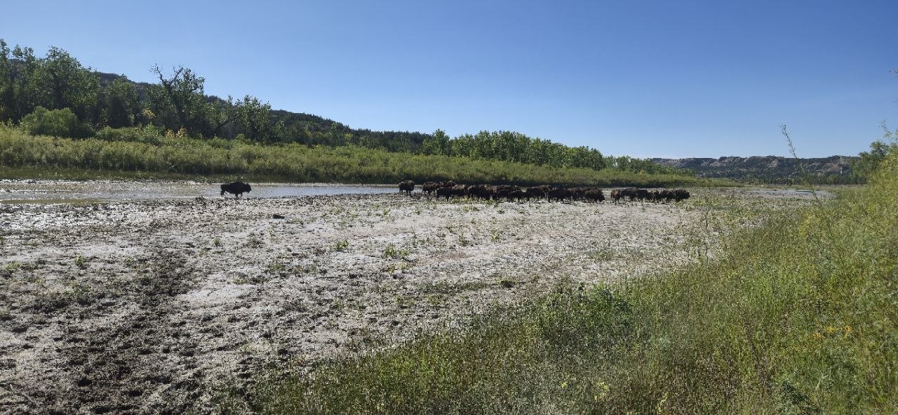 The herd at the river crossing, bunched up along the water right where I needed to cross.
The herd bunching up and the lead bull pushing them together, bellowing from about 75 yards out — recorded right as it happened.
If you’re hiking Achenbach, budget mental space for this. It’s not a trail where you casually stroll past bison at a distance — the terrain funnels you and them into the same narrow river-bottom corridor. See our full bison safety guide before you go, and give every herd more room than feels strictly necessary.
The River Crossing
By the time the herd moved off enough to let me through, the crossing itself wasn’t too bad. Water was low for September, and I found a reasonable spot to cross — though “reasonable” still meant a bit of a running start and a jump, and I still put one foot in the river anyway. Check current conditions before you go; this crossing has no bridge, and low water in September is not a guarantee any other time of year.
The far bank was the harder part to navigate — the vegetation there is thick, and it took some searching to pick the trail back up. Worth knowing going in so you don’t assume you’ve lost the route entirely.
Fossils and Petrified Wood on the Far Side
Once across, I came across several petrified tree stumps on the climb back up the far side, and spent some genuine time looking around — you never know what you’ll turn up out there, and this stretch delivered.
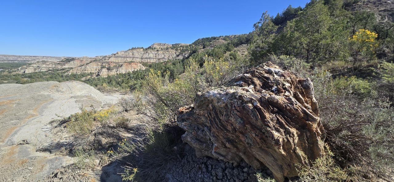 One of several petrified stumps along the far side of the crossing.
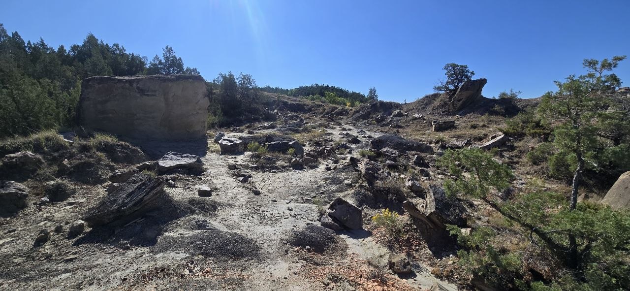 On the climb back up the other side — good fossil-hunting terrain if you’re willing to poke around.
The Turnaround Point
I climbed up to a vantage point on the far side, above the valley, and that’s where I called it and turned back. That overlook is the payoff for the far side of the crossing — wide views back down over the badlands and the river corridor you just fought your way through.
What I’d Do Differently Next Time
- Bring a battery backup for your phone. AllTrails was doing heavy lifting for navigation given how unreliable the trail marking is, and that burns battery fast.
- Bring more snacks. A ~10-mile badlands round trip with real elevation change and a river crossing takes more fuel than I packed.
- Start earlier. I didn’t get moving until around 10am Central, which was too late — give yourself the full length of the day, especially if you’re considering the full point-to-point to Juniper Campground instead of an out-and-back.
- Watch for posted advisories at the trailhead. There was an active Extreme Heat Advisory posted at the trailhead sign the day I went — conditions and postings change, so read whatever’s actually posted the day you hike, not just what a trip report tells you.
What I Carried
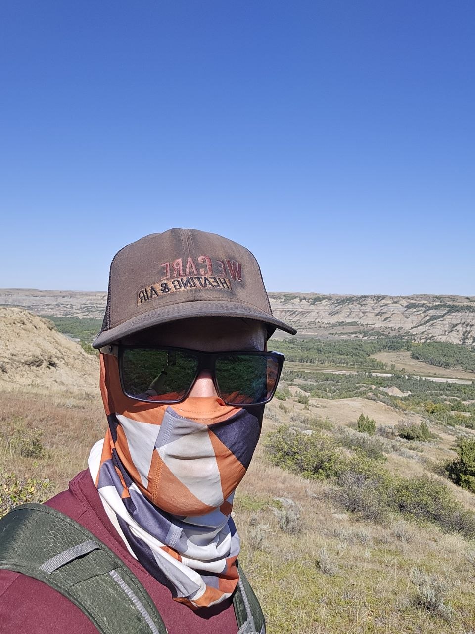 Above the valley on the way out, wearing the gaiter linked below.
- Ascend Mojave Low Waterproof hiking shoes — my go-to; I’ve logged a lot of miles in these and they held up fine through the river crossing
- Outdoor Products day pack — nothing fancy, did the job; see our best hiking daypacks if you’re shopping for one
- PackLite Life neck gaiter — wore ours on this hike
- A portable phone charger — the one thing I didn’t bring and wished I had, given how much I leaned on AllTrails
- AllTrails — effectively required gear on this particular trail, not optional
Who It’s For
If you want a hike that’s genuinely just you and nature — no crowds, no chatter, no well-worn tread to follow — South Achenbach delivers that about as purely as anything in the park. But that’s also all it is. There’s no safety net of other hikers nearby, the trail can vanish on you, and you will likely be sharing the river bottom with bison at close range. Go in prepared, go with navigation you trust, and don’t treat the remoteness as a bonus feature you can ignore the responsibility side of.
Bottom Line
- The quietest, most remote trail I’ve hiked in the North Unit — solo the entire way except near the trailhead.
- Bison are the headline wildlife here — three herds, 50+ animals, and a close, memorable encounter right at the river crossing.
- Not well-marked. Bring a GPS app and expect to lose the trail line at least once, especially past the river.
- I’m going back to do the full South Achenbach to Juniper Campground once the fall colors turn — this stretch alone was good enough that I want the whole thing.
More from Theodore Roosevelt National Park: Caprock Coulee Trail · Halliday Well Trailhead · Boicourt Trail · Bison Safety.
Go Light. Go Far. Live Wild.
Frequently Asked Questions
How long is South Achenbach Trail?
Do you have to cross the Little Missouri River on South Achenbach Trail?
Is South Achenbach Trail well-marked?
How much wildlife will I see on South Achenbach Trail?
Get the Sub-10 lb Ultralight Gear Checklist
Join the free PackLite Life newsletter — new gear guides, trip reports, and trail-tested tips — and grab the printable checklist when you sign up. No spam, unsubscribe anytime.