
Like guides like this? Get new ones by email.
I hiked out from Halliday Well Trailhead in the South Unit of Theodore Roosevelt National Park in July, and it turned into one of those short, humbling hikes that teaches you more about the badlands than a much longer trip would. Rolling grassland, sandstone walls, a muddy little creek, more bison than I expected, and heat that ended the hike early. Here’s the honest, first-hand version.
Plan your visit: Check the official Theodore Roosevelt National Park NPS page for current conditions and alerts in the South Unit before you go.
The Quick Stats
- Distance: ~6 miles round trip (I turned back at 3 miles out because of the heat)
- Full trail: the trailhead accesses the West Loop, an 11.4-mile roundtrip loop rated moderate with occasionally steep sections
- Difficulty: Moderate, per NPS trailhead signage
- When I went: July, ~105°F
- Where: South Unit, Theodore Roosevelt National Park, North Dakota
Finding the Trailhead
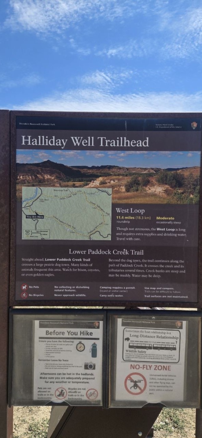
This one’s easy. Halliday Well Trailhead is a clearly signed offshoot right off the main park loop road in the South Unit — no rough access road, no guesswork, just pull in and park. The interpretive sign at the trailhead lays out both options clearly: the long West Loop (11.4 miles, moderate, occasionally steep) heading one direction, and the Lower Paddock Creek Trail straight ahead, which crosses a large prairie dog town before following Paddock Creek and its tributaries.
I went out on the Lower Paddock Creek side.
The Hike
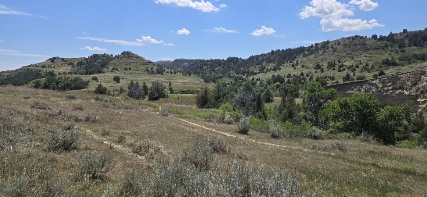
The trail opens into wide badlands terrain almost immediately — rolling grass and sage hills, sandstone outcrops, and the kind of big-sky openness that makes you feel very small.
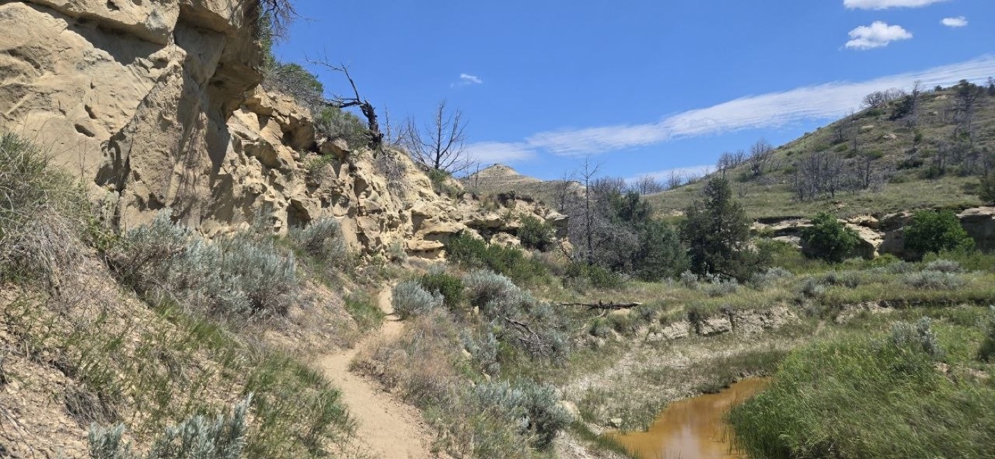
Past the prairie dog town (more on those cuties below), the trail follows Paddock Creek through a section with sandstone walls on one side and a narrow, muddy creek running alongside — genuinely pretty, and a nice change of terrain from the open grassland.
Underfoot, the trail turned into a fine, dry powder in spots — you could see obvious wallows where bison had been dust-bathing right on the trail itself. Otherwise the tread was fine and easy to follow. This is genuinely a short, easy trail by badlands standards; what made it feel like more of an effort was the heat.
Bison, Up Close (Closer Than Planned)
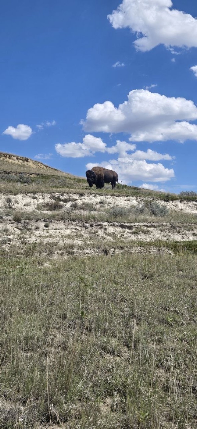
I saw a lot of bison on this hike, and one surprised me at close range. That’s the thing that stuck with me most: even in wide-open terrain where you’d think you could see an animal that size coming from a mile away, they can seem to appear out of nowhere — grazing just over a rise, or tucked behind sage you didn’t think was tall enough to hide anything. This one was calm the whole time, but it ended up closer than I would have chosen, and I managed distance as best I could given how it played out.
The lesson: don’t assume open terrain means you’ll have plenty of warning. Scan rises and dips as you walk, and know your plan before you’re already close. See our full bison safety guide — the short version is 25 yards minimum, always, and bison injure more park visitors than any other animal because people underestimate them.
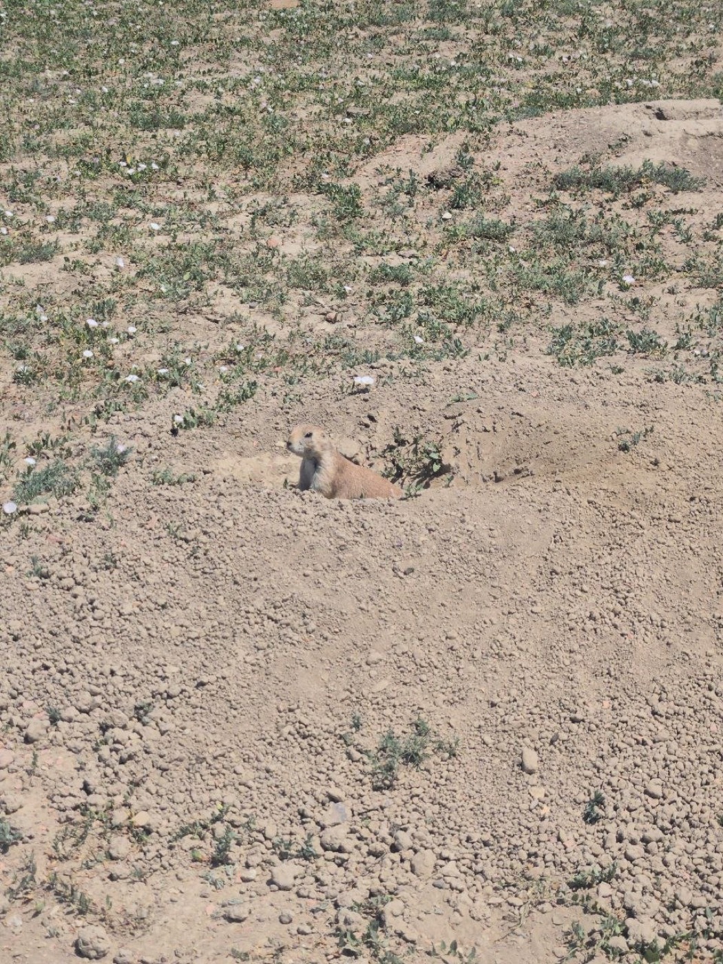
I also passed a lively prairie dog town — genuinely one of the highlights, watching them pop up, bark alarm calls, and duck back down as I walked by. No wild horses or elk on this trip, which I was hoping for, but that’s a good excuse to go back.
The Heat Ended My Hike Early
It was around 105°F, and that’s the real reason I turned around at 3 miles instead of pushing further. Badlands terrain has close to zero shade — you’re exposed the entire way — and I went through water fast. This wasn’t a long or technically hard hike, but the heat alone was enough to make the call to turn back rather than press on toward a longer loop.
If you’re hiking this trail (or the full West Loop) in summer, take the heat seriously even though the mileage looks modest on paper.
Tips for Hiking Halliday Well / Lower Paddock Creek Trail
- Carry more water than feels necessary. In summer heat with no shade, you’ll go through it faster than you expect — see our guide to how much water to carry and our ultralight water system setup for a carry system that makes refilling and rationing easier.
- Go early. Morning starts beat the worst of the afternoon heat, especially if you’re eyeing the full 11.4-mile West Loop.
- Watch for rattlesnakes — badlands terrain is good habitat, and the dry, sage-lined trail is exactly the kind of place to watch your foot placement.
- Don’t assume you’ll see bison coming. Even in open country, scan rises and dips, and keep 25+ yards of distance always.
- Creek crossings can be muddy or deep on the Lower Paddock Creek Trail, per the trailhead signage — expect wet feet in spots.
- Trails here aren’t heavily maintained and can be hard to follow in places — bring a map or GPS, not just a phone.
- No pets or bikes are allowed on this trail, and camping requires a permit from the visitor center.
What to Pack
Badlands terrain in summer means sun and heat management above everything else — a sun hoodie and real water capacity matter more here than anywhere else I’ve hiked recently. Good footwear for loose, dusty trail and a reliable water filter setup round it out if you’re extending this into a longer loop.
Bottom Line
- Easy to find, easy to underestimate. The trailhead is simple, but the heat and lack of shade can shorten your plans fast — mine did.
- Bison are the highlight and the hazard. Expect to see them, expect them to be calm, and don’t expect a warning before you’re closer than you planned.
- Worth going back for. I’d like to do the full 11.4-mile West Loop next time, ideally starting at first light to beat the heat.
More from Theodore Roosevelt National Park: 📚 Full Park Guide · Boicourt Trail · Caprock Coulee Trail (North Unit). More badlands and wildlife safety: Bison Safety · How to Watch Wildlife Safely · How Much Water to Carry Backpacking.
Go Light. Go Far. Live Wild.
Frequently Asked Questions
Where is Halliday Well Trailhead?
How long is the hike from Halliday Well Trailhead?
Is it safe to hike near bison in Theodore Roosevelt National Park?
Get the Sub-10 lb Ultralight Gear Checklist
Join the free PackLite Life newsletter — new gear guides, trip reports, and trail-tested tips — and grab the printable checklist when you sign up. No spam, unsubscribe anytime.