
Like guides like this? Get new ones by email.
Caprock Coulee is my favorite trail in the North Unit of Theodore Roosevelt National Park — and honestly, between the two units, I favor the North Unit a little bit over the South. This loop is a big reason why. Great views, real wildlife encounters across multiple visits, a fun scramble, and one of the best overlooks in the entire National Park System. Here’s the honest, first-hand version.
Plan your visit: Check the official Theodore Roosevelt National Park NPS page for current conditions and alerts in the North Unit before you go. See our first-hand reports from the South Unit: Halliday Well Trailhead and Boicourt Trail.
The Quick Stats
- Distance: ~5-mile loop
- Elevation gain: Minimal (~500 ft) — but the trail goes up and down repeatedly before returning to the trailhead
- Difficulty: Moderate, though a willing novice can do it without much trouble
- When I’ve hiked it: Multiple times — once in spring, a couple of times in summer, most recently in August
- Where: North Unit, Theodore Roosevelt National Park, North Dakota
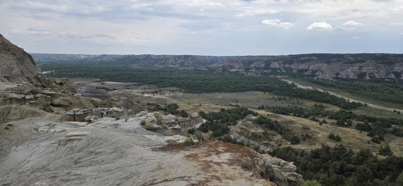
Finding the Trailhead
Easy — you drive right past it on the North Unit’s main road, no searching required. I’ve hiked this loop several times now and access has never been an issue.
My Route: East Side First, Prairie Dog Town, Then Back
I like to hike up the east end of the trail first, out toward the prairie dog town, then complete the loop back to the trailhead. Doing it in this direction has worked well for me every time — you get the prairie dog town and the open badlands stretch early, then work toward the river and the caprock scramble as the loop closes.
The caprock scramble — the short, hands-on rocky section near a caprock formation — comes as part of completing the loop. It sounds more intimidating than it is: it’s not technical, and it’s honestly one of the more fun parts of the whole hike.
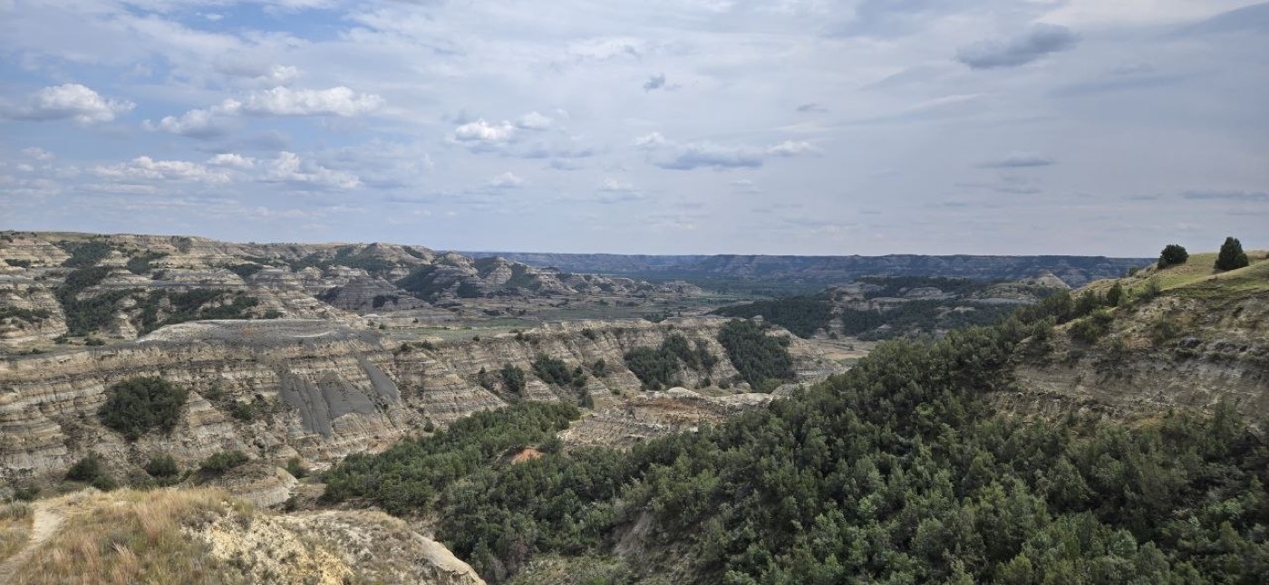
River Bend Overlook: The Best Stop in the Park
River Bend Overlook sits right on this loop, and in my opinion it’s the single best stopping point in the entire park — South Unit included. You come out onto a rim looking straight down on a dramatic hairpin bend of the Little Missouri River, with layered badlands buttes stacked on both sides of the valley. There’s a historic CCC-built log shelter right at the overlook, and an interpretive sign that calls it “the view that launched a park” — accurate, in my opinion.
I haven’t caught it at sunset yet, but I imagine it would be gorgeous down there with that light on the river bend. Keep an eye out for moose in the river bottom below the overlook — they’re definitely around, and I’ve seen several down there over multiple visits. See our moose safety guide if you spot one.
Wildlife
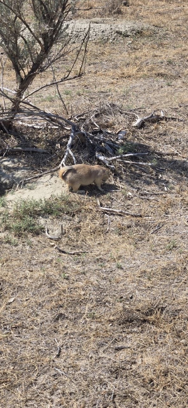
This loop has been consistently good for wildlife across every visit. I’ve seen bison, prairie dogs, coyotes, and deer here, and on one occasion this past spring, bighorn sheep — a genuine highlight and not something I’ve run into elsewhere in the park. The prairie dog town on the east side is reliably active, and bison sightings have been common enough that I’d call them the expected norm on this trail, not a lucky bonus.
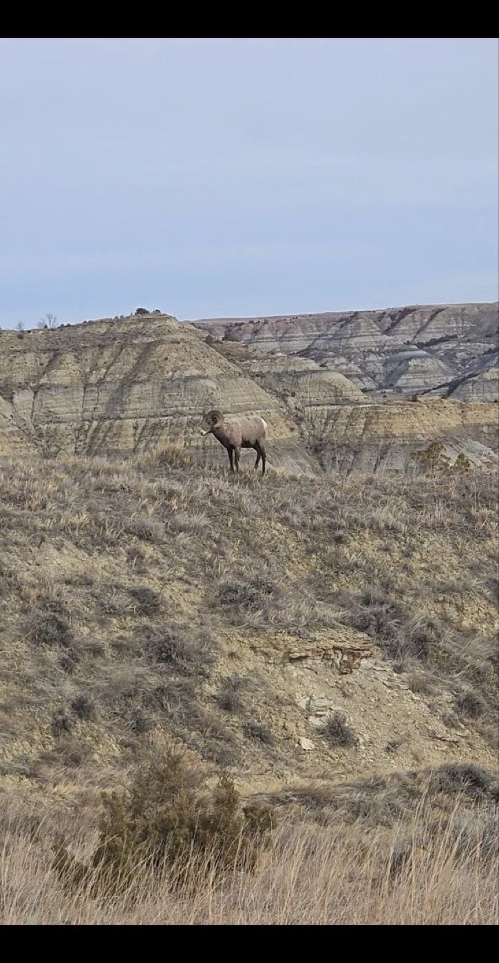 From a spring visit — the dormant grass and bare branches are a giveaway it isn’t the same August trip as the rest of these photos.
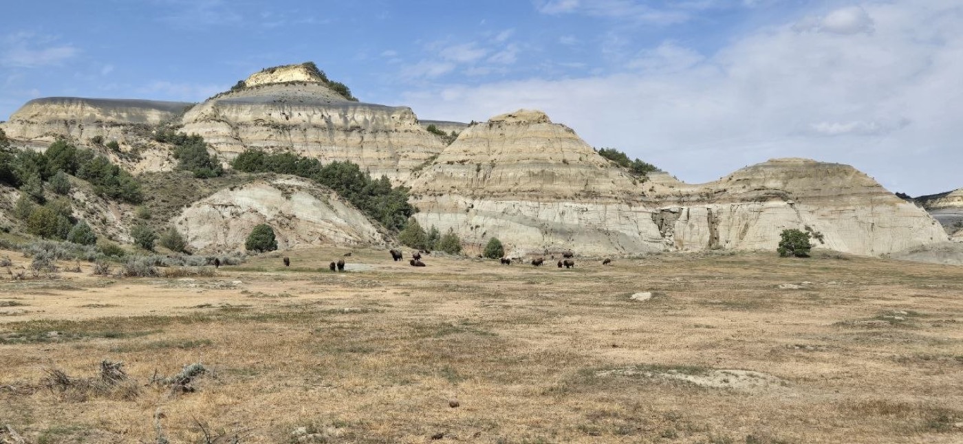
As always with bison: enjoy them from a real distance. See our bison safety guide for the specifics.
The Weather Warning: Watch the Clay
This is the one thing I’d tell anyone before they hike Caprock Coulee: check the weather and recent storm history before you go. The clay soil on parts of this trail turns genuinely treacherous when wet — from rain, or even runoff from a storm that passed through a day or two earlier. It gets so slick it’s almost impossible to walk on, and it balls up heavily on your boots and shoes, adding weight and making footing worse with every step.
If it’s rained recently, or rain is in the forecast, reconsider or reroute. This isn’t a “watch your step” caution — it’s a “this trail may not be safely hikeable” caution.
Tips for Hiking Caprock Coulee Trail
- Good hiking shoes or trail runners with real tread are worth having — see our best footwear picks.
- Check the weather and recent rain history before you go — wet clay here is a real hazard, not a minor inconvenience.
- Bring water — badlands terrain means real sun exposure for most of the loop.
- Watch for bison on the open stretches and give them plenty of room.
- Scan the river bottom below River Bend Overlook for moose — bring binoculars if you have them.
- Don’t rush the caprock scramble — it’s not hard, but it’s the one spot on the loop where you’re using your hands.
What to Pack
Solid footwear matters more here than almost anywhere else in the park given the clay conditions — see our best hiking shoes and trail runners. Bring enough water for a 5-mile badlands loop (see our guide to how much water to carry), sun protection, and binoculars if you want a real shot at spotting moose or bighorn sheep from the overlooks.
Bottom Line
- My favorite trail in the North Unit, and part of why I favor the North Unit slightly over the South.
- River Bend Overlook alone is worth the hike — the best single viewpoint I’ve found in the park.
- Reliable wildlife, including a rare bighorn sheep sighting this spring, on top of the usual bison, prairie dogs, coyotes, and deer.
- Respect the clay. Check the weather first — this is the one real hazard on an otherwise moderate, novice-friendly loop.
More from Theodore Roosevelt National Park: South Achenbach Trail · Halliday Well Trailhead · Boicourt Trail · Bison Safety · Bear & Moose Safety.
Go Light. Go Far. Live Wild.
Frequently Asked Questions
How long is Caprock Coulee Trail?
Does Caprock Coulee Trail pass River Bend Overlook?
Is the caprock scramble on this trail difficult?
What should I know before hiking Caprock Coulee Trail?
Get the Sub-10 lb Ultralight Gear Checklist
Join the free PackLite Life newsletter — new gear guides, trip reports, and trail-tested tips — and grab the printable checklist when you sign up. No spam, unsubscribe anytime.